
Portage Brûlé Hot Springs
Portage Brûlé Hot Springs
Hot Spring
Multiple natural pools of varying temperatures found along the Liard River.
Located on the north bank of the Liard River in British Columbia, Canada, Portage Brûlé hot springs is a hidden gem for those seeking relaxation and natural beauty. Accessible only on foot from the Alaska Highway, the hot springs are situated about 3 km downstream from the mouth of the Coal River.
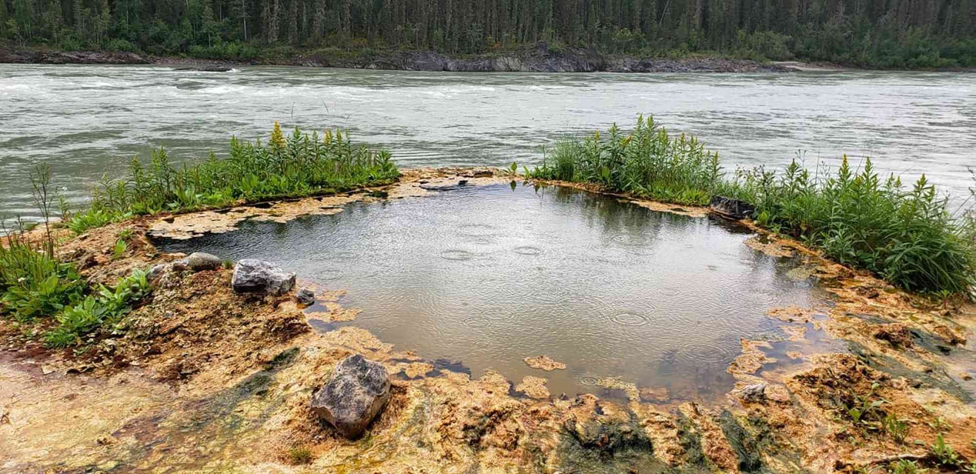
The hot springs feature as many as 15 seeps issuing from bedrock along about 300 meters of river bank between the Liard River and a clay bank above. The water temperatures range from 20° to 48°C (68° to 118°F), with most springs hovering around 35°C (95°F). The spring water is colorless, odorless, and moderately high in dissolved solids, including bicarbonate, calcium, sulfate, chloride, and magnesium. Gas bubbles from many of the springs.
Many of the springs have formed small tufa terraces and mounds, with several having small pools suitable for soaking. The best pool, formed from hardened tufa, is about 3 meters (10 ft.) across by 1 meter (3 ft.) deep, with hot water swelling up from the algae-covered bottom. Two nearby vents with good flow rates are 48 ˚C (118 ˚F).
The tufa formations are predominantly red, orange, or brown, providing a striking contrast with the abundant green and red algae. However, it can be challenging to navigate to the hot springs, and approach details are unknown, so NTS map 92M/10 will be helpful. Portage Brûlé hot springs can be a winter wonderland, with the water temperatures around 98°F mid-winter.
Address
Notable GPS Co-ordinates
Detailed Directions
To get to Portage Brule Hot Springs, start at Coal River, which is 65 km north of Liard Hot Springs on the Alaska Highway. From the general store, drive 8.2 km (5 mi.) south on the Alaska Highway to a large pull-out with a big black sign. From there, walk or drive 1.3 km (1 mi.) north to a large culvert running down to the nearby Liard River. Walk down the culvert to the Liard River and hike about 2.5 km (1.6 mi.) upstream along the shoreline to the Portage Brule Rapids. Just before the rapids, rock cliffs will force you up onto the Portage trail, which may be marked by flagging tape and is kept in usable condition by paddling enthusiasts. Continue along the trail, which hugs the cliff edge for approximately 1.5 km (1 mi.), looking out for yellow-colored limestone and tufa just above the waterline below. The hiking time from the highway to the hot springs is about 2 hours, and the round-trip hiking time is around 4 hours, possibly longer if the water level in the Liard is high.
Leave a comment
You must Login to post a comment!