
Sloquet Hot Springs
Sloquet Hot Springs
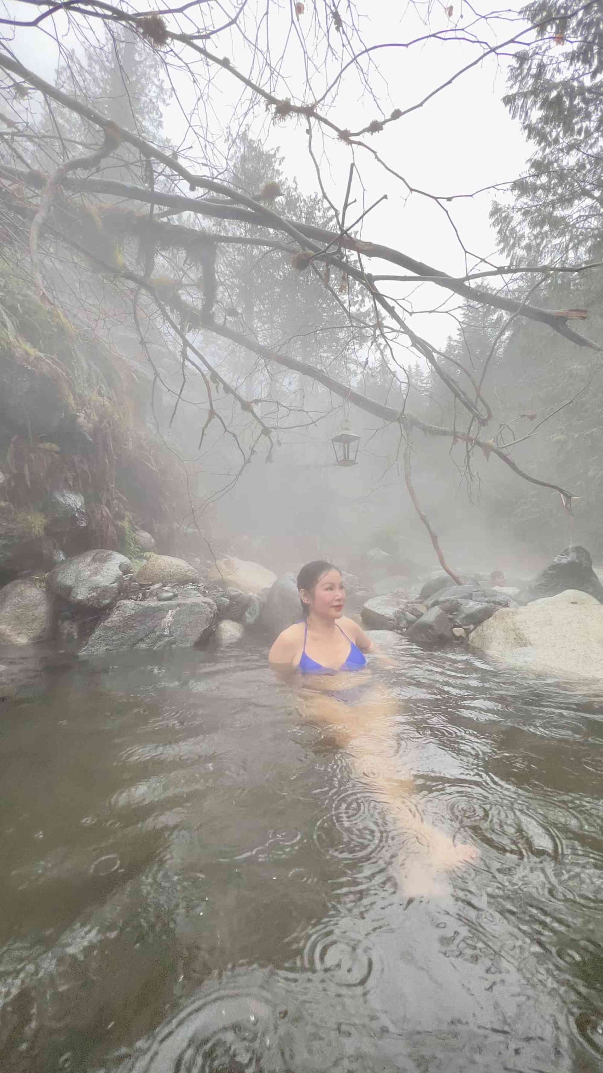
Hot Spring
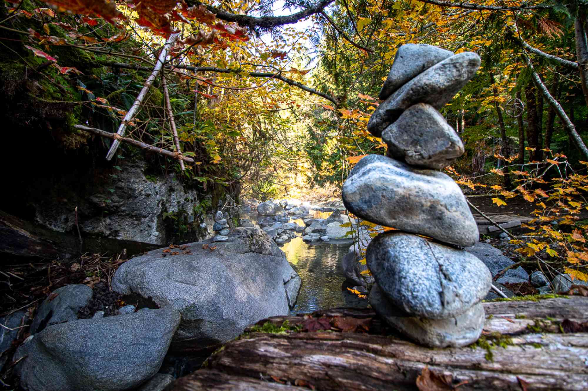
Rstic rock pools along a creek in traditional Xa'xtsa First Nation territory.
Written and photos by Ryan Lepper.
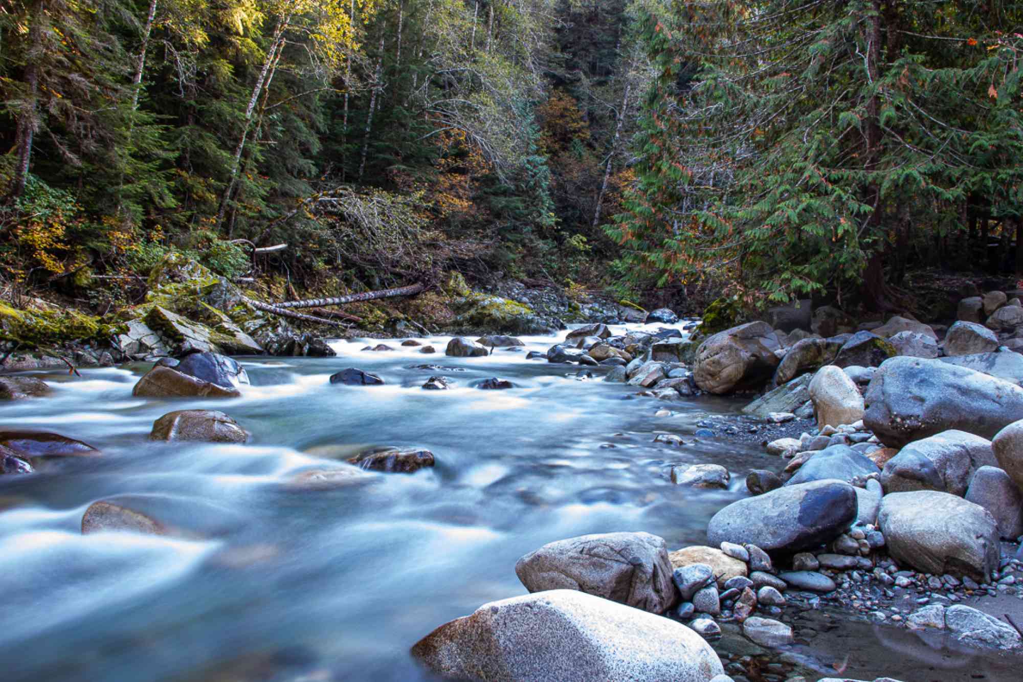
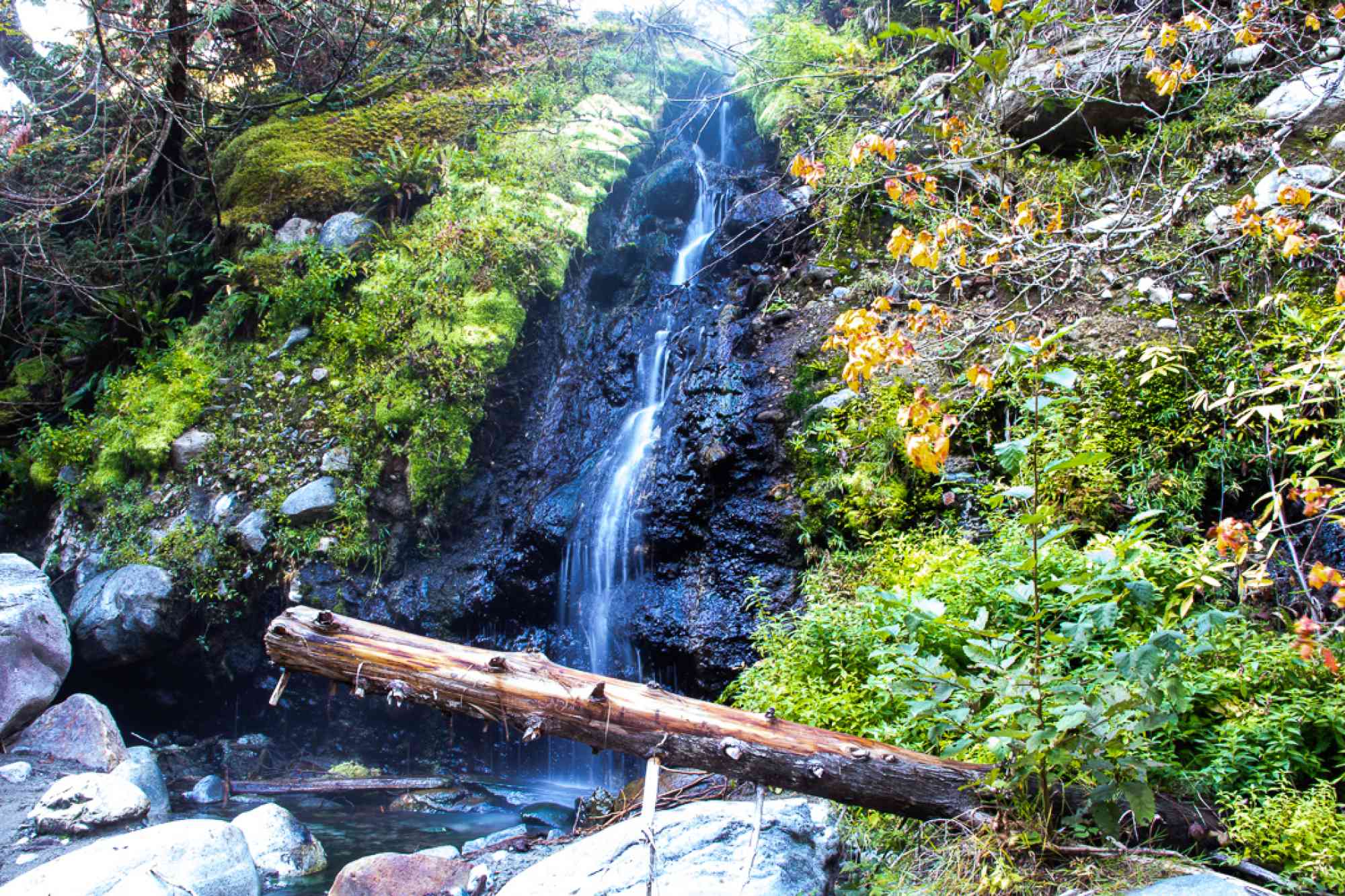
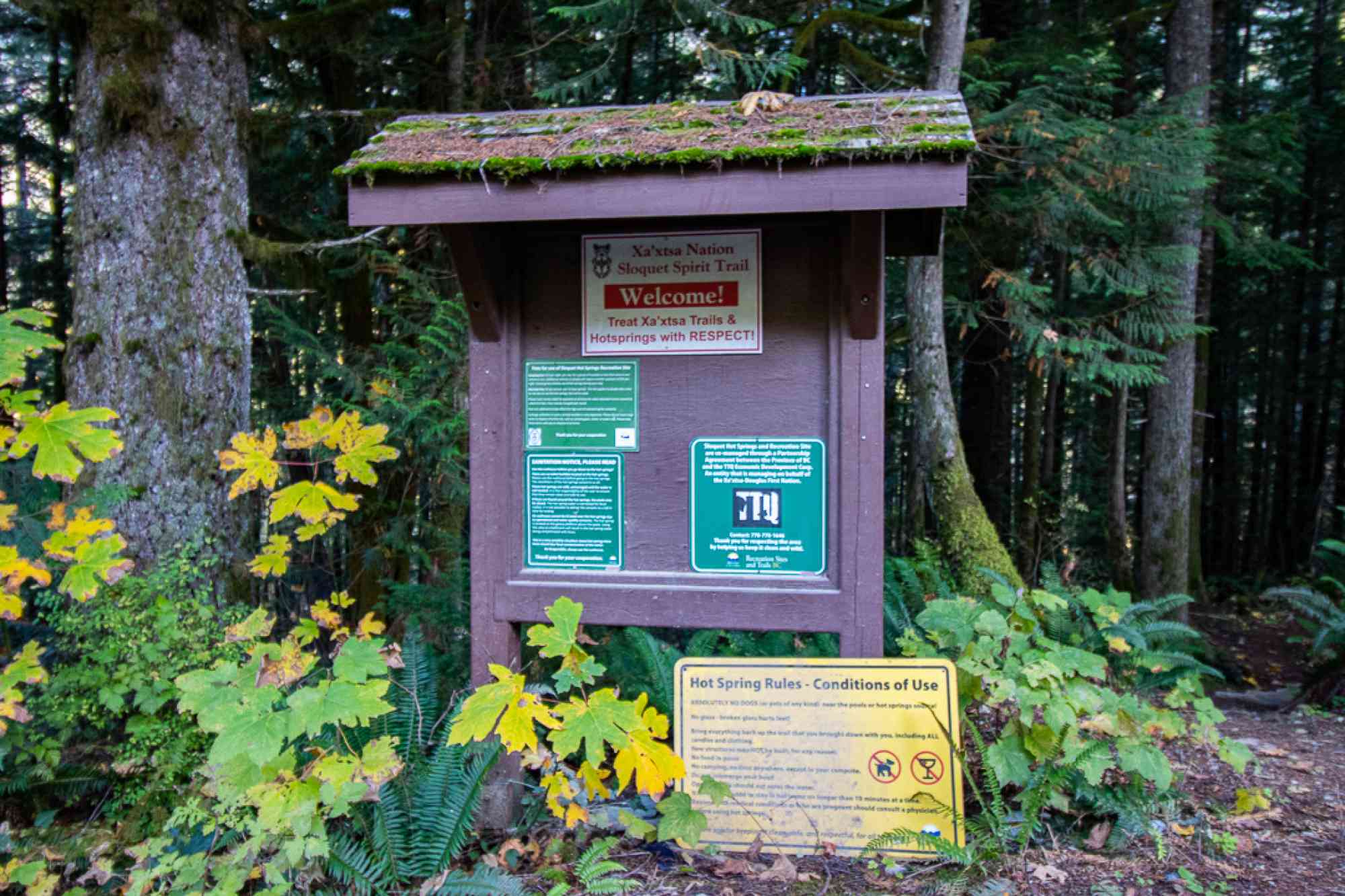
Sloquet Hot Springs is a beautiful, rustic and natural hot spring set in manmade rock pools along the side of Sloquet Creek. A small hot spring waterfall feeds the several staggered rock pools before descending into the creek. The springs are located in the traditional territory of the Xa’xtsa First Nation (Douglas First Nation) who have been using these hot springs for generations. The springs are managed in partnership between the local first nations and BC Recreation Sites and Trails.
Whether you come in from the south or the north, Sloquet Hot Springs is located roughly 90KM down scenic (and potholey) gravel Forest Service Road.
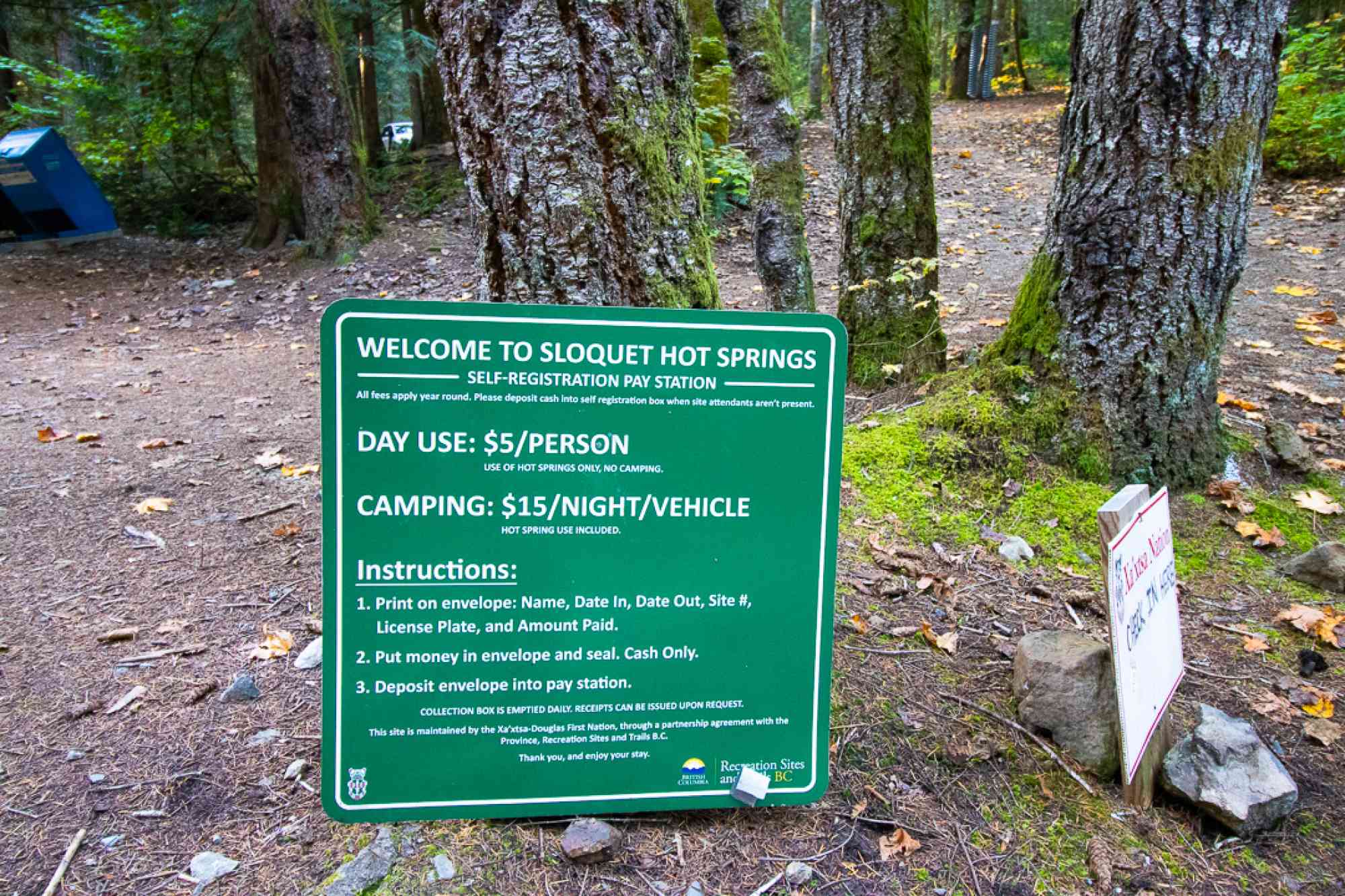
Day use and camping is available. Fees are collected year-round although they are sparsely collected during the winter months.
Day use for the springs is $10 per person
Camping is $20 a night per site
(cash only)
The camping fee includes use of the hot springs. Every overnight vehicle must have a camping permit displayed on their dash. The fee applies to groups of 6 people. If there are more than 6 people in one vehicle, a second permit is required for the extra people
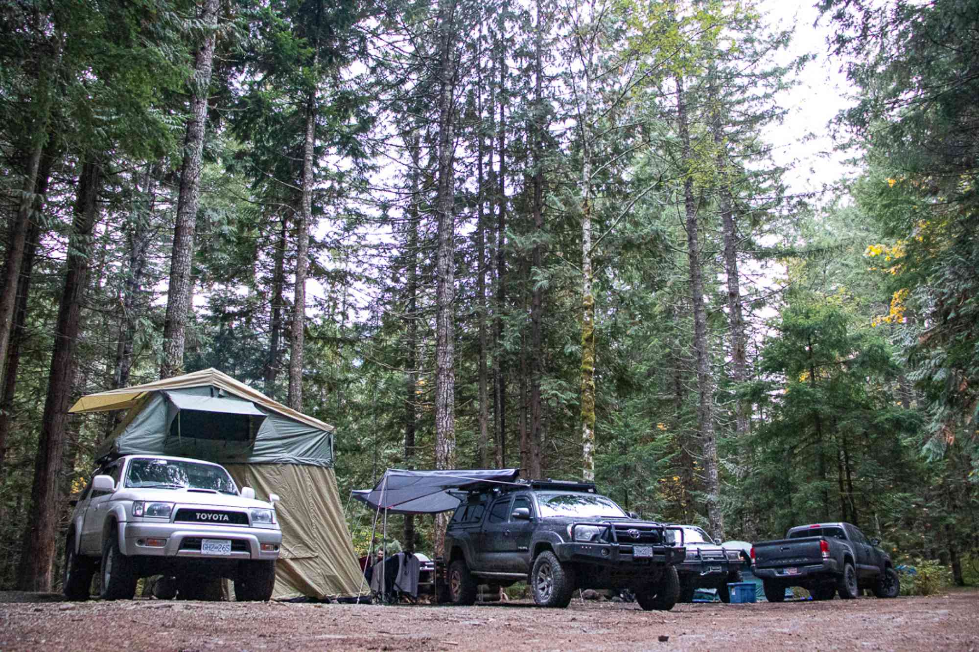
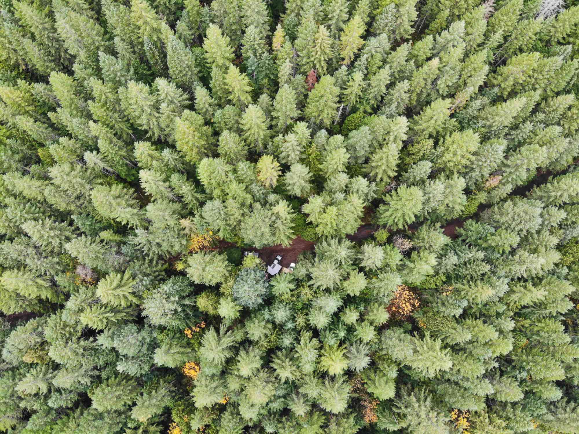
There are roughly a dozen spread out sites available for camping which are set in the forest above the springs. Most sites have a fire ring and picnic table and there are outhouses available for use. Most sites can accommodate multiple tents/vehicles. Please follow “No Trace” principles and pack out what you pack in. RVs/Trailers are not recommended here due to rough road conditions and very little room to turn around and setup within the campground area.
The hot springs are located next to Sloquet Creek about a 5-minute hike down a steep and rocky trail from the campground/day use parking area.
Cautions
Travel with your headlights on at all times. These are active industrial roads. The In-Shuck-ch Forest Service road can be rough and is known to eat tires. Please ensure you have a proper full size spare and the means to swap it.
No pets of any kind are allowed at, or near the Hot Springs. The campground area is pet friendly.
This campground gets extremely busy on weekends and holidays. Arrive early if you plan on camping during a weekend/holiday.
The Xa'xtsa village of Tipella is 2km South of the turn off to the hot springs. There is a gas station and small store there with limited supplies. Chuck Tires is also located in Tipella if you find yourself in need of tire repair.
It is common for Sloquet Creek to wash-out the Springs during heavy rainfalls and spring run off.


Address
Notable GPS Co-ordinates
Detailed Directions
- Along Highway 99 approx 17km north of Pemberton town centre take the turn off to the right onto In-Shuck-Ch Forest Service Road. You will see signage for both Sloquet and Skookumchuck (T’sek) Hot Springs.
- Travel for approx. 76.5 km on the In-shuck-ch Forest Service Road (also known as Lillooet lake road) until you come to a large concrete/steel bridge crossing the Lillooet River. Continue across and turn left at the T intersection shortly after the bridge.
- Travel another approx. 5 kms till you will see a turn-off to the right and a sign for Sloquet Hot Springs.
- After turning off the main FSR (Forest Service Road) you will immediately come to another Y in the road. Go left and follow this road for roughly 9km before coming to another Y and sign board on the left that welcomes you to the site. Take a left at this final Y and you will begin to climb the last hill up to the campground area. This last section of road from the welcome signage to the campground can get very rutted out and rough.
Depending on current road status, washouts and closures you can also get there in a high clearance 4x4 via the Harrison West FSR (now called St'sailes FSR) which takes you North along Harrison Lake. The first 50ish KM of this road are fairly well maintained. It is the north section of this road once you near the northern tip of Harrison Lake that will require a high clearance 4x4 vehicle. If you travel 76 kms along Harrison West you will come to the same turn off/sign listed in directions #3 above.
For road updates on road conditios visit:
https://www2.gov.bc.ca/gov/content/industry/natural-resource-use/resource-roads/local-road-safety-information/sea-to-sky-natural-resource-district-road-safety-information/road-conditions-in-sea-to-sky-district
Leave a comment
You must Login to post a comment!